|
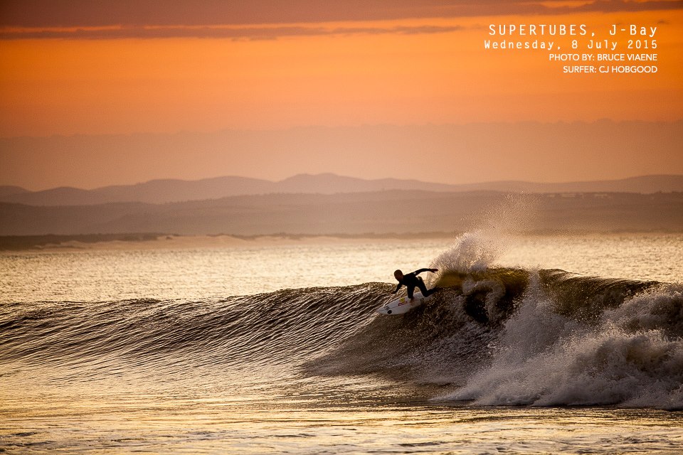
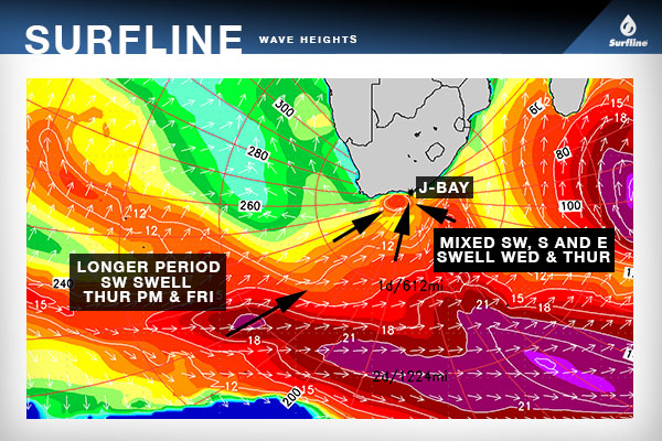
The biggest show in town is upon us. The JBay Open's waiting period has officially begun, but a lay day was called thanks to teeny swell (by JBay standards!) and pomping wind. There are 2 Saffa's in the event, with wildcard Slade Prestwich coming up in heat 6 and Jordy in heat 11. Jord's reckon's his knee is feeling better after an injury to it saw him miss Fiji. Both John John Florence and Jeremy Flores are outta the event. John's ankle's still stuffed, and Jeremy did a seri-ass face plant into the reef recently which fractured his face in a few spots. Might be hard to pick a winner, cos the swell isn't looked too all-time, which means big barrels and big carves could be replaced by an air game. Here's Surfline's forecast for the event: "For the opening day of the waiting period we will see decreasing, short period E swell from high pressure currently drifting eastward past South Africa; lully, building and longer period SW swell from a recent fetch deeper in the South Atlantic; and some short period W swell that should develop from a nearby fetch in the next 12-18 hours. The W and E swells will primarily bypass and/or be blocked from reaching J-Bay, with a fraction of the energy from each respective swell wrapping in, while the SW swell was from a storm/fetch that was never aimed especially well at J-Bay. Taking all of that into consideration, we should see rather jumbled surf (especially by J-Bay standards) in the waist-shoulder high range on Wednesday, with some sets to head high possible over the afternoon and evening on the low/incoming tide and as the longer period SW swell builds. Wind will be breezy offshore for clean surface conditions and we do anticipate contestable surf, although not of the highest quality.
On Thursday all of the above mentioned swells will be trending down, with some new, shorter period S swell building from a nearby fetch developing in the next 12 hours and new, longer period SW/SSW swell also filling over the afternoon. If the nearby fetch behaves as forecast in the half day or so we should see shoulder-head high surf Thursday AM, building to head high to a couple feet overhead by the later afternoon and evening hours. Friday could see a holding to slowly fading trend in the mixed southerly swell with size on Friday morning similar to Thursday afternoon. Unfortunately, it also looks like we’ll see unfavorable onshore easterly flow both days. At this point it looks like the shorter period S swell and long period SSW swell will be fading by Saturday along with N/devil wind in the morning, although latest model guidance points to improving conditions Saturday afternoon as flow shifts to the NW/WNW. Stay tuned. Going a little further out, there is nothing major on the radar right now. However, we will monitor a pair a pair of groundswells that forecast guidance currently indicates would be in the mid size range and we may need to really pick the eyes out of these modest swells with varying conditions. Our next swell of interest could start to build on Sunday, with a possible peak Monday and maybe into Tuesday with medium size surf (roughly similar to Thur PM/Fri). Right now the swell looks really ‘west’ in direction on Sunday and would mainly bypass J-Bay. However, if the swell directions trends more SW/SSW on Mon/Tue- as is currently indicated by model guidance- we could see more size. Wind on Sun/Mon currently looks favorable (WSW/W), with onshore/E flow possibly returning Tuesday. Stay tuned. Beyond that, another mid size SW swell looks possible right around the end of the waiting period (18th-19th). Stay tuned."
0 Comments
Leave a Reply. |
Archives
August 2021
|
